This article explains the methodology and data sources used to determine typical weather conditions in Monterrey, Mexico. Our analysis is based on a comprehensive statistical review of historical hourly weather reports and model reconstructions spanning from January 1, 1980, to December 31, 2016. Understanding the origin of this weather data is crucial for interpreting its accuracy and limitations.
Temperature and Dew Point Data
Data concerning temperature and dew point for Monterrey is derived from a network of weather stations in the vicinity. Three stations are considered sufficiently close to contribute reliable data for our estimations.
To ensure accuracy for Monterrey’s specific location, records from each station are adjusted to account for elevation differences. This correction is performed using the International Standard Atmosphere model. Further refinement is achieved by incorporating relative changes observed in the MERRA-2 satellite-era reanalysis data between the station locations and Monterrey.
The final estimated temperature and dew point values for Monterrey are calculated as a weighted average. This method considers the individual contributions from each station, with weights assigned proportionally to the inverse of the distance between Monterrey and the respective station. This ensures closer stations have a greater influence on the Monterrey weather estimations.
The weather stations contributing to our Monterrey weather reconstructions are visually represented on the map below:
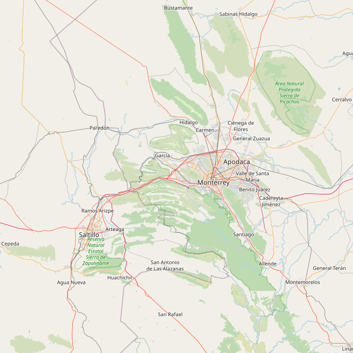 Weather stations near Monterrey, Mexico, contributing data for weather analysis.
(Map © OpenStreetMap contributors)
For those interested in a deeper dive, a detailed comparison is available. This comparison illustrates the agreement between Monterrey and the contributing stations concerning temperature history and climate patterns. It’s important to remember that each station’s data is adjusted for elevation and relative changes found within the MERRA-2 dataset.
Sources for Other Weather Data
Beyond temperature and dew point, a variety of sources inform our broader Monterrey weather data. Calculations for solar position, including sunrise and sunset times, are based on established astronomical formulas. These are derived from the authoritative text “Astronomical Algorithms 2nd Edition” by Jean Meeus.
All remaining weather data, encompassing cloud cover, precipitation levels, wind speed and direction, and solar flux, originates from NASA’s MERRA-2 Modern-Era Retrospective Analysis. This advanced reanalysis system integrates diverse, wide-ranging measurements into a sophisticated global meteorological model. This allows for the reconstruction of hourly weather history across the globe on a 50-kilometer grid resolution.
Geographical land use data is sourced from the Global Land Cover SHARE database, published by the Food and Agriculture Organization of the United Nations. Elevation data is provided by NASA’s Jet Propulsion Laboratory, utilizing the Shuttle Radar Topography Mission (SRTM) data.
Information regarding place names, locations, and time zones for various locations and airports is obtained from the GeoNames Geographical Database. Time zone data specific to airports and weather stations is provided by AskGeo.com. Map data is © OpenStreetMap contributors.
Important Data Limitations and Disclaimers
It is essential to understand the limitations inherent in weather data and the models used to generate it. The weather information presented here is provided “as is,” without guarantees regarding its accuracy or suitability for specific purposes. Weather data, by its nature, is susceptible to errors, outages, and other inaccuracies. We, therefore, assume no liability for decisions made based on the content presented within this report.
We specifically emphasize a degree of caution regarding our reliance on MERRA-2 model-based reconstructions for several key data series. While MERRA-2 offers significant advantages in terms of temporal and spatial completeness, it is important to acknowledge its limitations:
- Model-Based Errors: MERRA-2 data is generated from computer models, which may have inherent model-based errors.
- Coarse Spatial Resolution: Data is sampled on a 50 km grid, which may not capture local variations in microclimates accurately.
- Coastal Area Challenges: MERRA-2 can face difficulties accurately representing weather patterns in coastal regions, particularly around smaller islands.
Furthermore, our travel scores are only as reliable as the underlying data. Real-world weather conditions at any given time and location are inherently unpredictable and variable. The definition of our weather scores reflects a particular set of preferences that may not align with every individual’s expectations.
For a comprehensive understanding of our terms and conditions, please refer to our Terms of Service page.