The Gulf of Mexico, an area closely monitored for tropical development, has spawned a new threat as a disorganized system intensified into Tropical Storm Francine on Monday. This development, confirmed by the National Weather Service, highlights the ever-present potential for tropical cyclones to form in the Gulf of Mexico, a region known for its warm waters and conducive atmospheric conditions during hurricane season.
Currently churning through the Gulf, Tropical Storm Francine is packing sustained winds of 50 miles per hour. To put this in perspective, a tropical storm is characterized by winds ranging from 39 mph to 73 mph, indicating Francine is already a significant weather system. As of Monday, projections indicate the storm’s path will take it just south of Houston on Wednesday, before making landfall along the Louisiana coast by Wednesday evening.
The U.S. National Hurricane Center in Miami reported Francine’s location on Monday to be approximately 245 miles southeast of the mouth of the Rio Grande. Even at this distance, the storm is already impacting the region, with heavy rainfall spreading across northeastern Mexico and deep South Texas. Some areas in these regions are bracing for rainfall totals potentially reaching up to 12 inches through Monday night, raising concerns about flash flooding.
Forecasters predict that Tropical Storm Francine will further intensify, potentially reaching hurricane status as it approaches the northwestern Gulf Coast on Wednesday. This intensification brings with it the increased risk of a significant storm surge, which could reach up to 10 feet in some coastal areas. Residents along the coast are urged to monitor updates and prepare for potential inundation.
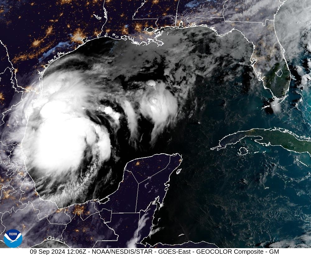 NOAA satellite image of Potential Tropical Cyclone Six brewing in the Gulf of Mexico.
The National Hurricane Center has issued warnings about the widespread impacts of Francine. “Francine is expected to bring heavy rainfall and the risk of considerable flash flooding along the coast of far northeast Mexico, portions of the southernmost Texas coast, the Upper Texas Coast, southern Louisiana, and southern Mississippi into Thursday morning. A risk of flash and urban flooding exists across portions of the Mid-South from Wednesday into Friday morning,” the center stated. This broad area of potential impact underscores the far-reaching consequences of a tropical cyclone forming in the Gulf of Mexico.
Tropical storm watches are in effect for parts of the southern and far eastern Texas coast, while hurricane watches have been issued for a significant portion of Louisiana. These watches indicate the increasing likelihood of tropical storm and hurricane conditions within the specified areas, prompting residents and authorities to activate preparedness plans.
The National Weather Service in Houston has announced a Coastal Flood Warning set to begin Tuesday night for coastal areas north of Sargent and around Galveston Bay. This warning anticipates a storm surge of 1 to 3 feet from Freeport to High Island, further emphasizing the coastal flooding threat associated with Tropical Storm Francine.
While current forecasts predict rain totals of up to two inches for the immediate Houston area as the storm passes on Wednesday, officials caution that even a slight westward shift in the storm’s track could increase the potential effects on Houston. As of Monday, the probability of hurricane-force winds in the Houston region remains less than 5 percent, but this could change as the storm evolves.
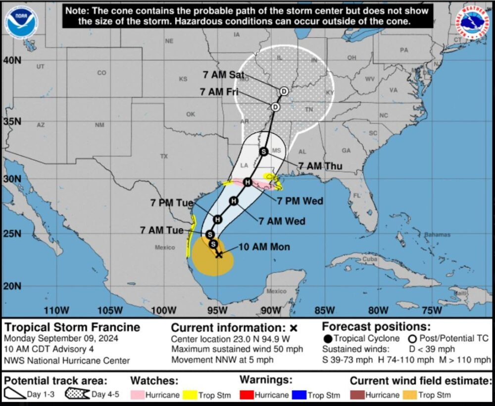 Projected storm track of Tropical Storm Francine, showing its path across the Gulf of Mexico and towards the Louisiana coast.
Texas Governor Greg Abbott has already taken proactive steps, directing the state’s emergency management division to activate emergency resources in anticipation of the storm’s projected landfall on the Texas coast this week. Governor Abbott stressed the importance of preparedness, urging Texans to monitor road conditions and finalize their emergency plans. “Texas stands ready to provide all available resources needed to support Texans as a severe storm system begins to move along the Gulf Coast that will bring potential flash flooding threats and heavy rain,” he stated.
CenterPoint Energy, a major utility provider in the region, has also announced heightened vigilance in preparation for Tropical Storm Francine. Following criticism for their response to Hurricane Beryl last month, CenterPoint Energy assures customers they are mobilizing resources and mutual assistance to ensure rapid power restoration should the storm impact their service area. “We are in the process of mobilizing all of our available resources and mutual assistance resources from other utility companies so we will be prepared to safely and quickly restore power to our customers should this tropical system impact our area,” said spokesperson Darin Carroll.
As Tropical Storm Francine continues to develop and move across the Gulf of Mexico, residents along the Gulf Coast are urged to stay informed, heed warnings from local officials, and take necessary precautions to ensure their safety. The potential for tropical cyclone formation in the Gulf of Mexico remains a significant concern during hurricane season, and Francine serves as a timely reminder of the region’s vulnerability to these powerful storms.