Planning a trip to the stunning island of Cozumel, Mexico? Whether you’re dreaming of world-class scuba diving, relaxing on pristine beaches, or exploring Mayan ruins, having a good map is essential. As a seasoned traveler in Mexico and content creator for gaymexico.net, I understand the importance of detailed and helpful resources to make your vacation seamless. This guide provides you with a variety of Cozumel maps, ensuring you find your way around this beautiful Caribbean island with ease.
Cozumel is renowned as one of the top scuba diving destinations in the Caribbean, and for good reason. Its crystal-clear waters and vibrant coral reefs teem with marine life. Even if you’re not a diver, the island offers a plethora of attractions, from beach clubs and bars to historical sites. While Cozumel is relatively easy to navigate – famously featuring just one main road circling the island – a map enhances your exploration and helps you discover hidden gems.
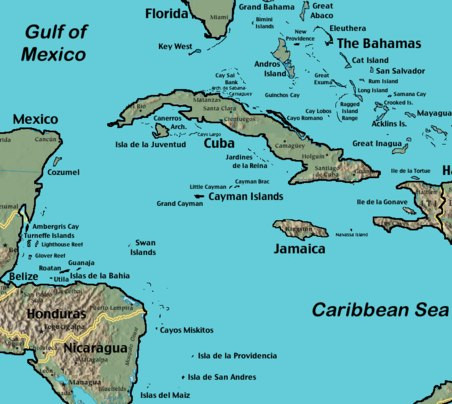
Let’s start by placing Cozumel in its geographical context with some location maps, before diving into detailed island maps and interactive tools to help you plan your perfect Cozumel adventure.
Cozumel Location Maps
To understand Cozumel’s place in the world, it’s helpful to see it in relation to mainland Mexico and the wider Caribbean region. Cozumel is an island located off the eastern coast of the Yucatan Peninsula. These maps will give you a clear picture of its location.
 Map showing the location of Cozumel in relation to the Yucatan Peninsula and surrounding areas
 Animated map showing the geographical location of Cozumel
Detailed Cozumel Island Maps
Once you have a sense of Cozumel’s location, a detailed island map becomes invaluable. These maps highlight key areas, roads, towns, and even some points of interest. While the ruins on Cozumel might not be as grand as those on the mainland, the island map helps you locate various attractions and plan your routes.
 Detailed map of Cozumel island showing roads, towns, and points of interest
Interactive Cozumel Map
For a more dynamic and user-friendly experience, an interactive map is a fantastic tool. This type of map allows you to zoom in and out, explore different areas in detail, and often provides names of places as you navigate. It’s a fun and practical way to get acquainted with Cozumel before you even arrive.
Zoom in to explore downtown Cozumel and locate the cruise ship terminal. You can also easily spot the ferry pier, just to the right of the cruise ship area on the map.
To further aid your trip planning, you might find our Cozumel island overview page incredibly useful. It’s packed with information about the island’s layout, hotels, weather, water temperatures, diving conditions, and much more.
Cozumel is a truly special destination, and I hope these maps help you plan an unforgettable trip. Whether you’re there for the diving, the beaches, or simply to explore, enjoy your time on this beautiful Mexican island! Safe travels and happy exploring!