El Malpais National Monument, a name that translates from Spanish to “bad country,” might sound uninviting at first glance. However, this designation hardly captures the dramatic beauty and unique geological wonders that await visitors. Located about an hour west of Albuquerque, Malpais, New Mexico, is a high-desert landscape where ancient volcanic forces have sculpted a terrain unlike any other. While my own ambitious itinerary for exploring El Malpais in a single November day proved to be a bit too much, focusing on the highlights revealed an unforgettable landscape.
Initially, my plan included detours to El Morro National Monument and the Bandera Ice Caves. However, the shorter daylight hours of November and the seasonal closure of the ice caves (a lesson learned for next time!) necessitated a more focused approach. We decided to immerse ourselves in El Malpais itself, and it was a decision we didn’t regret.
El Malpais, a blend of National Monument and National Conservation Area, sits on the edge of the Colorado Plateau. At first glance, the high desert environment can appear desolate. But a closer look reveals a surprising resilience of life, with plants and animals adapted to thrive amongst the volcanic rocks, including several species found nowhere else. Our day was dedicated to exploring these stark yet vibrant landscapes.
Our first stop was the El Malpais Visitor Center in Grants, NM. While helpful for those completely new to the area, if you have a basic itinerary in mind, it might be skippable. It served its purpose for a passport stamp and a souvenir, but for in-depth understanding, the NCA Visitor Center is superior.
For a richer introduction to the geology and history of Malpais New Mexico, head directly to the National Conservation Area (NCA) Visitor Center, situated off Highway 117 on the northeastern edge of the monument. This center provides valuable context before venturing into the landscape itself.
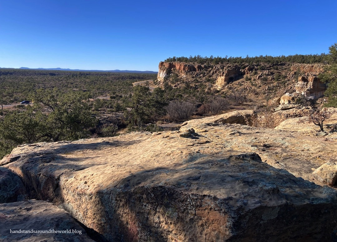
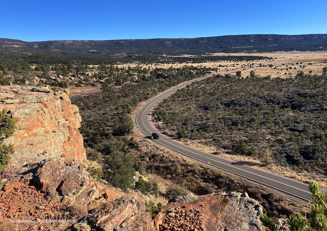
From the NCA Visitor Center, we drove south on Highway 117. The scenery quickly became captivating. To the west, towering red and tan sandstone cliffs rose majestically. To the east, a vast, undulating expanse of black volcanic rock stretched as far as the eye could see. This striking contrast is the essence of El Malpais. The sandstone layers were formed roughly 200 million years ago, initially by wind deposits and later by an ancient ocean. Over the last 3 million years, volcanic eruptions, numbering around a dozen, sent lava flows cascading through the sandstone canyons and valleys, creating the dramatic juxtaposition we see today.
Historically, this land was home to the ancestors of the Zuni, Acoma, and Laguna Pueblos, as well as the Ramah Navajo. Their oral traditions speak of witnessing the most recent volcanic eruptions. Later, settlers attempted to homestead here, but the harsh environment led most to seek easier lives elsewhere.
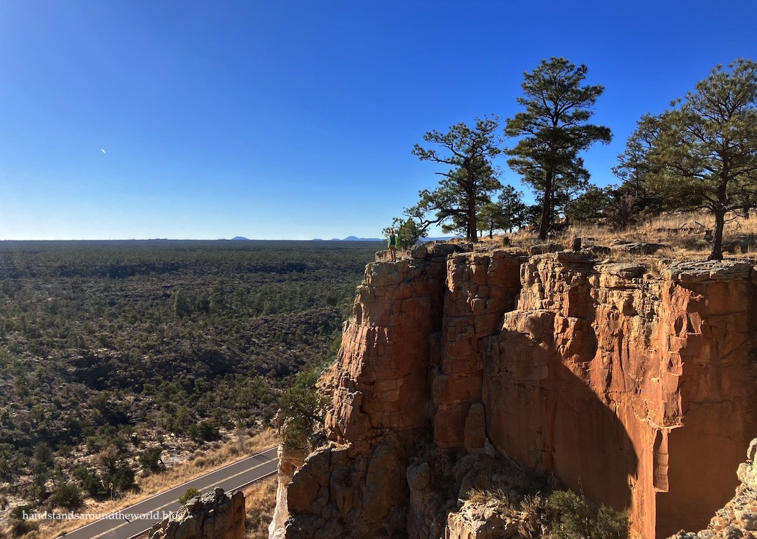
For the most panoramic perspective of this rugged terrain, the Sandstone Bluffs Overlook, just off Highway 117, is a must-visit. A short 1-mile gravel road leads to the overlook point. From here, you can explore the bluffs and take in the breathtaking views of the sprawling lava flows. We found it to be an ideal spot for a memorable picnic amidst the dramatic scenery of Malpais New Mexico.
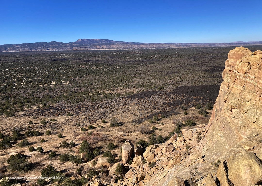 Sandstone Bluffs Overlook in El Malpais National Monument, showcasing the contrast between sandstone cliffs and black lava flows.
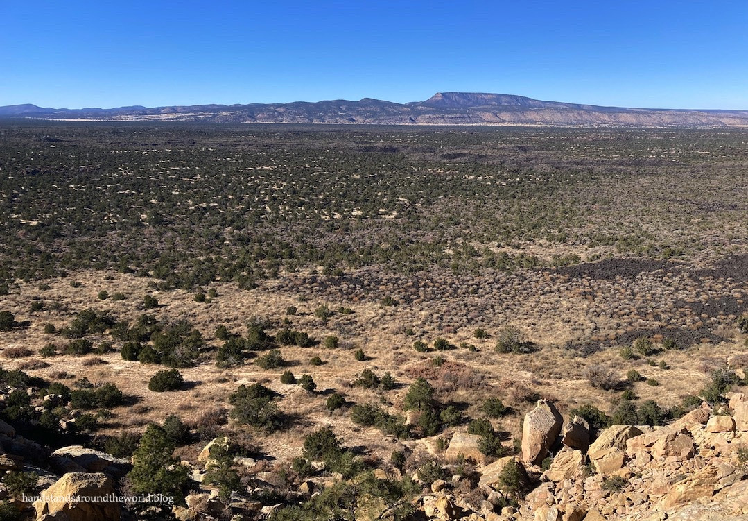 Vast expanse of black lava flows stretching across the landscape of El Malpais National Monument, viewed from Sandstone Bluffs Overlook.
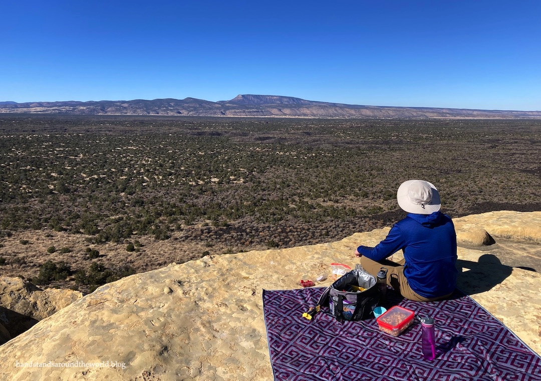 A picnic setup at Sandstone Bluffs Overlook, El Malpais National Monument, offering a scenic dining experience amidst volcanic landscapes.
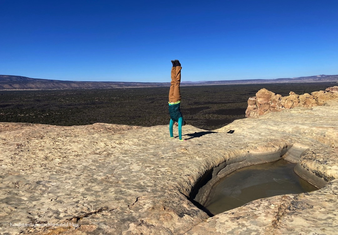 Traveler performing a handstand at El Malpais National Monument, with the volcanic landscape in the background.
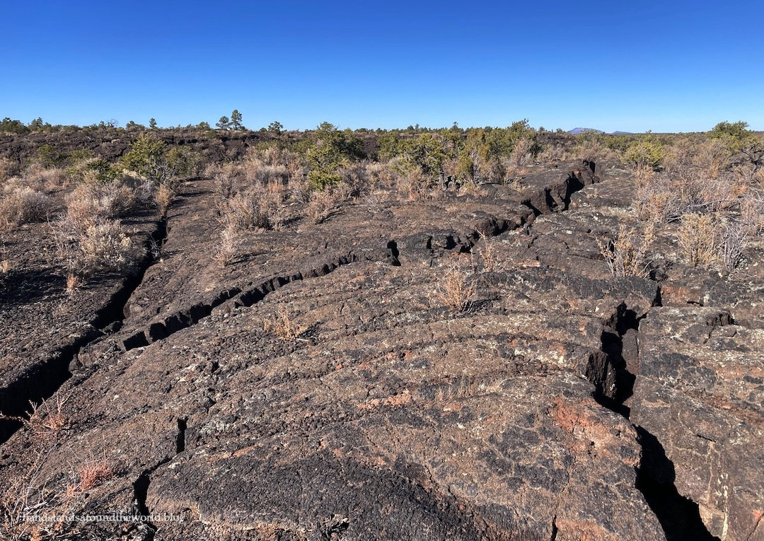
Continuing south, our next destination was the Lava Falls Trail, located at the monument’s southern end. This 1.2-mile hike traverses the McCartys lava flow, the youngest lava flow not only in the monument but in all of New Mexico, formed a mere 3,900 years ago. It was my husband’s first experience walking on a lava flow, and he was thoroughly impressed. Having previously visited Craters of the Moon National Monument, I found McCartys flow slightly less dramatic, but still a fascinating hike. The trail winds through diverse lava patterns, sinkholes, and cooling cracks. Rock cairns act as trail markers, essential in this seemingly trackless landscape where getting disoriented would be easy.
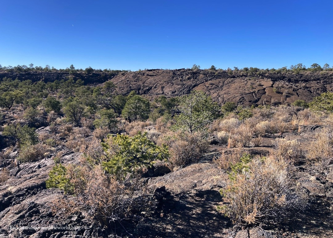 McCartys Lava Flow in El Malpais National Monument, showing the rugged and recent volcanic terrain.
 Close-up of pahoehoe lava, a ropy textured volcanic rock, found on the McCartys Lava Flow trail in El Malpais.
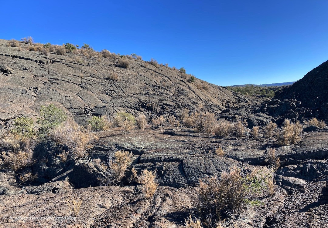 A natural lava amphitheater formation along the Lava Falls Trail in El Malpais National Monument.
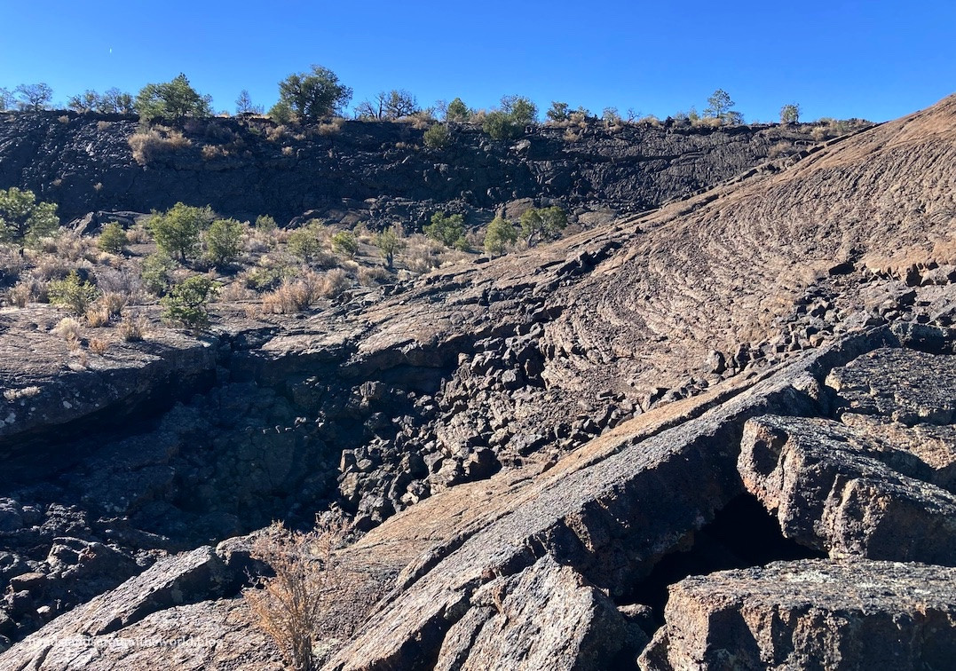
 Deep cracks in the lava along the Lava Falls Trail, highlighting the geological hazards and depth of the volcanic formations at El Malpais.
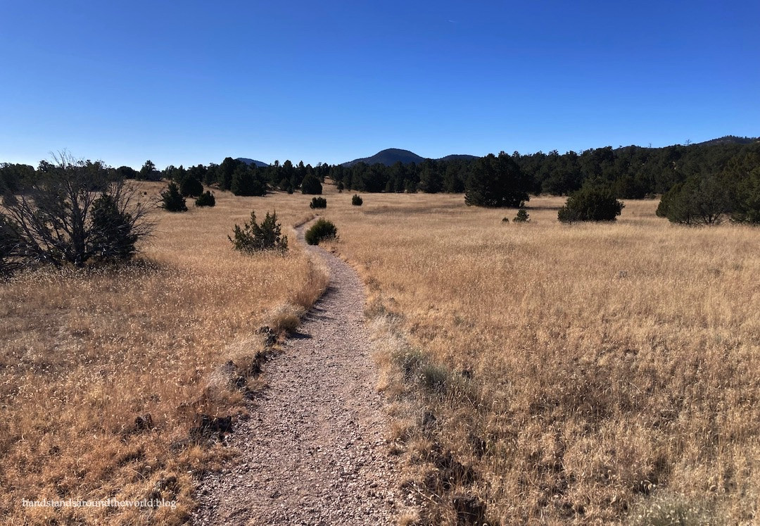
Heading back north, we made a stop at the Narrows Picnic Area, situated within the NCA section of El Malpais. The Narrows Trail extends for about 4 miles along the base of the sandstone cliffs. Following a ranger’s recommendation, we hiked about 0.6 miles to the 90-degree bend in the trail. This short walk rewarded us with another stunning vista of the unique Malpais New Mexico landscape.
 The Narrows Trail in El Malpais National Monument, winding along the base of sandstone cliffs.
 Panoramic view from the Narrows Trail turnaround point in El Malpais, showcasing the dramatic landscape and distant horizon.
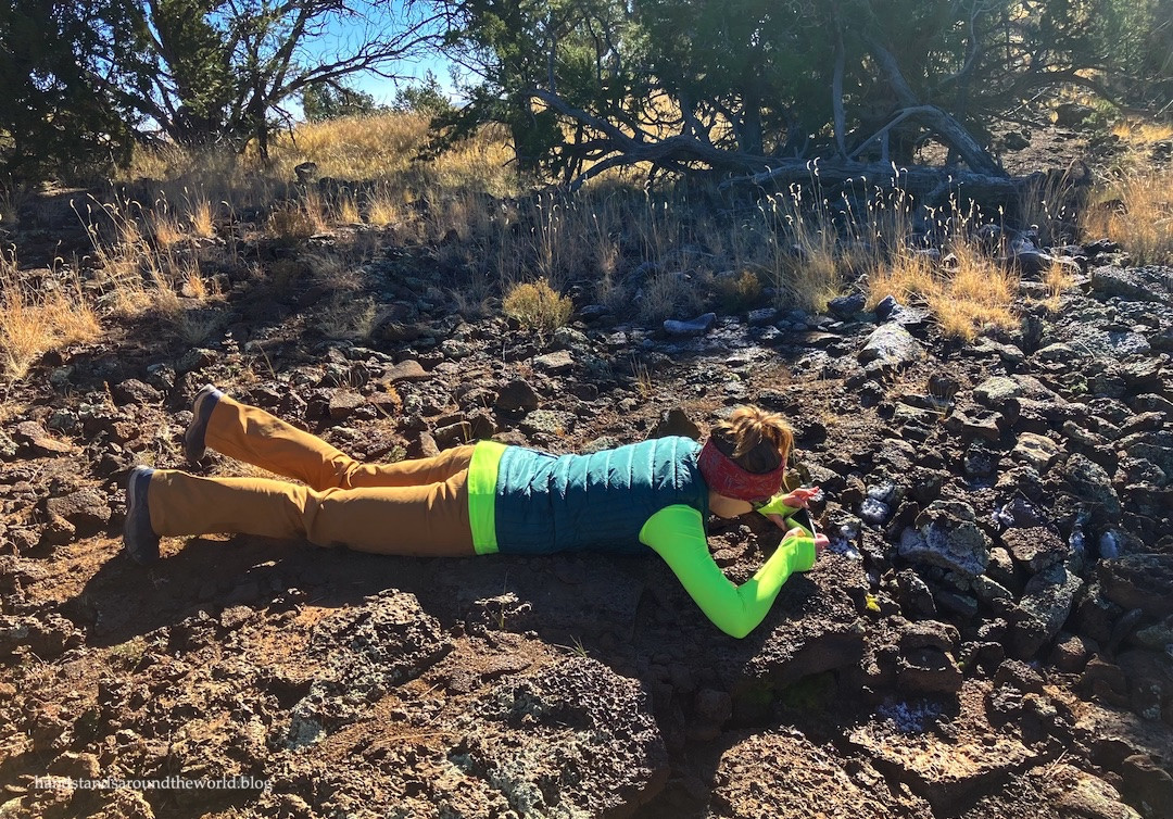
 Traveler blending in with the landscape at El Malpais, wearing clothing that matches the colors of the terrain.
Our final stop on Highway 117 was a quick half-mile round trip hike to La Ventana Arch. This impressive natural arch is the largest publicly accessible arch in New Mexico and the second largest overall in the state.
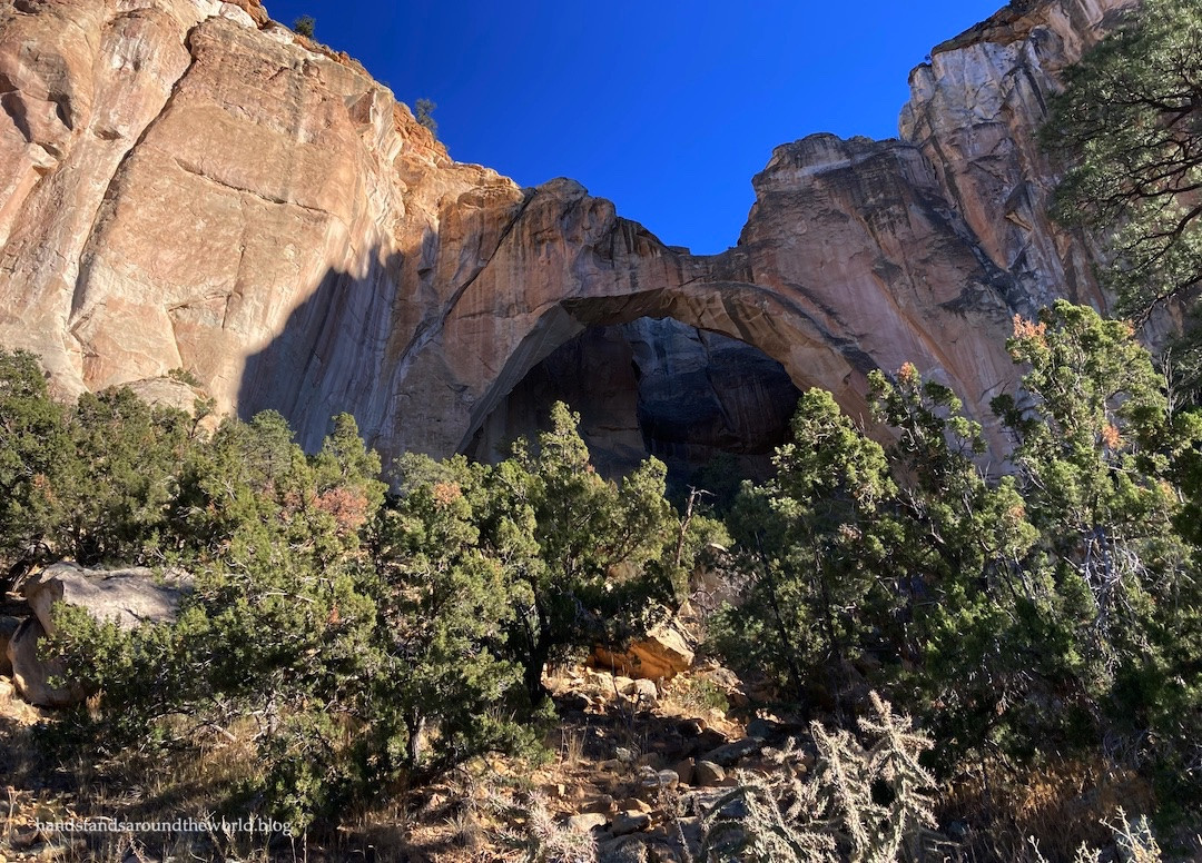 La Ventana Arch, the largest publicly accessible natural arch in New Mexico, located in El Malpais National Monument.
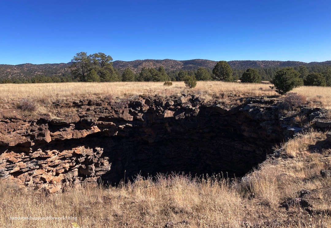
Lastly, although chronologically it was our first hike of the day, we explored the El Calderon Trail, located off Highway 53 in the northern section of the monument. The El Calderon Trail offers options for both a longer loop and a shorter out-and-back hike. We chose the shorter version, keeping right at each junction and discovering caves, sinkholes, a lava trench, grasslands, forest, and ultimately reaching the summit of El Calderon Crater.
 El Calderon Trail sign in El Malpais National Monument, marking the entrance to a trail through diverse volcanic features.
 Cave entrance along the El Calderon Trail in El Malpais, hinting at the underground volcanic formations.
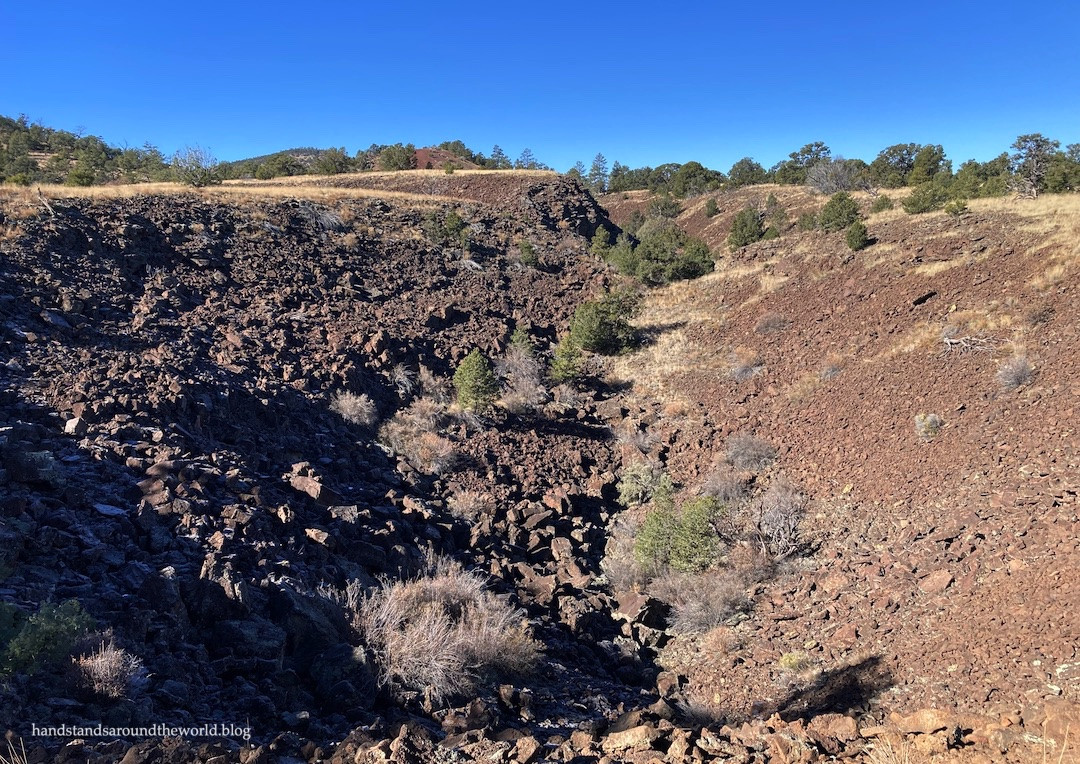 Lava trench, formed by the collapse of a lava tube roof, along the El Calderon Trail in El Malpais.
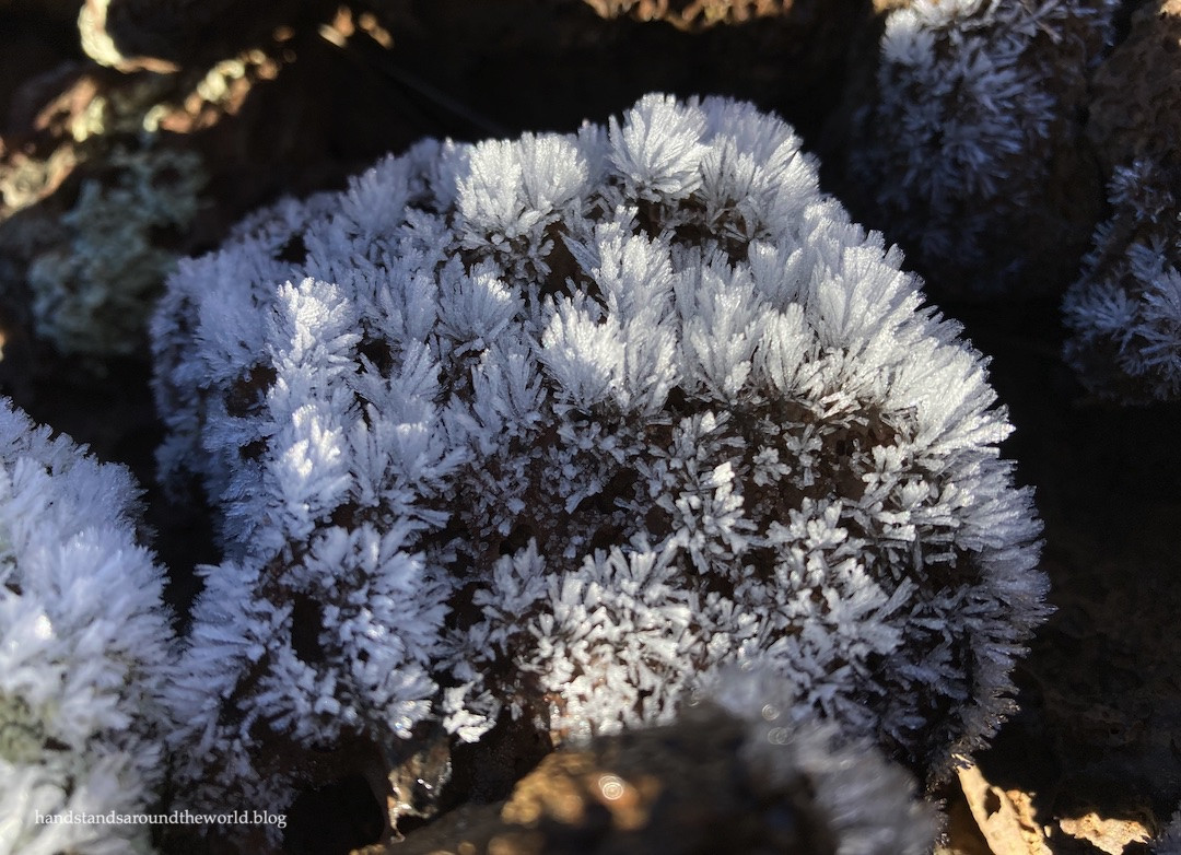 Ice crystals forming on lava rock, a detail observed along the El Calderon Trail, showcasing the contrasting elements of fire and ice in El Malpais.
 Close-up perspective of ice crystals on lava rock, illustrating the delicate beauty found within the rugged volcanic landscape of El Malpais.
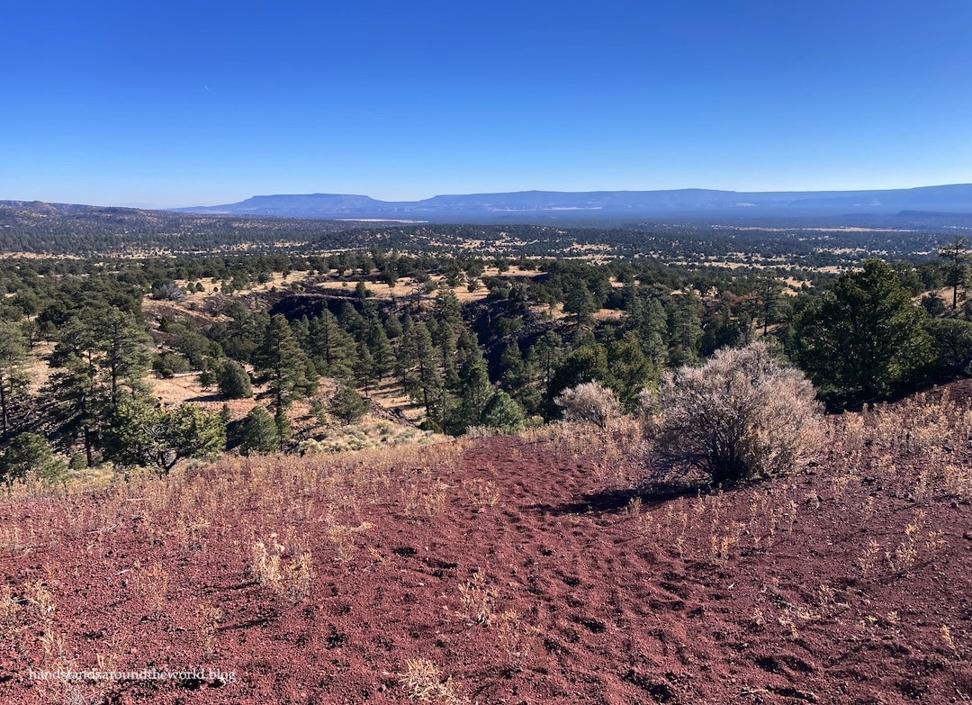 Summit view from El Calderon Crater in El Malpais, offering panoramic vistas of the surrounding volcanic terrain.
Our day in El Malpais only scratched the surface. This vast and uniquely shaped monument has much more to offer. Highway 53 borders the northern edge, and Highway 117 runs along the eastern side, providing the main access points. While 4WD vehicles can venture onto rougher roads in the southern and western areas, the central part of El Malpais is designated wilderness and remains largely inaccessible, preserving its pristine state.
Despite seeing a significant portion in a single day, we left much unexplored. Beyond the ice caves (closed during our winter visit) and lava caves (also seasonally closed), El Malpais boasts extensive lava flows and summer sunset bat emergence hikes from caves. A return trip to Malpais, New Mexico during the summer months is definitely in our future to experience the ice caves, lava caves, and bat viewing opportunities. For now, we cherish our initial encounter with this extraordinary and relatively undiscovered national monument.
Essential Information for Your Visit:
-
Directions: Access El Malpais via NM 53 and NM 117, both accessible from I-40 at Grants, NM (exits 81, 85, or 89). Be aware that these highways do not connect within the monument, requiring separate drives to experience all areas.
-
Entrance Fees: None – El Malpais National Monument is free to enter.
-
Important Considerations: El Malpais is a remote area with limited cell service and few facilities. Ensure you are well-prepared with ample food, water, fuel, layered clothing, and a reliable navigation system that functions without cellular connectivity.