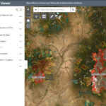
Central New Mexico is facing a wildfire emergency with the South Fork Fire and Salt Fire burning on Mescalero tribal land near Ruidoso. This page provides crucial information about these wildfires, including emergency resources, evacuation orders, and current fire conditions.
South Fork Fire: A Rapidly Growing Threat
The South Fork Fire, ignited on June 17, 2024, at 9 a.m., is located along the Rio Ruidoso, west of Ruidoso’s Upper Canyon area. Fueled by mixed conifer, the fire has exhibited extreme behavior, including long-range spotting and intense heat.
Current Status:
- Size: Estimated at 360 acres
- Containment: 0%
- Cause: Under investigation
- Structures: Multiple structures threatened; unknown number lost
Evacuations:
Mandatory evacuations are in effect for Upper Canyon, Brady Canyon, Ponderosa, Alpine Village, and Cedar Creek. Residents are directed to evacuate to the Ruidoso Convention Center at 111 Sierra Blanca Dr, Ruidoso, NM 88345. “SET” status (be prepared to evacuate) is in place for West Gavilan, Sun Valley, Sierra Vista, Villa Madonna, Ski Sun Road, and areas west of Highway 48. The Mescalero Apache Tribe has established an evacuation center for reservation residents at the Community Center Gymnasium.
Resources and Operations:
Mescalero Apache Fire Rescue, the Bureau of Indian Affairs, the US Forest Service, and multiple aviation assets are battling the blaze. A Complex Incident Management Team is on order to take over management. Due to rapid fire growth, ground crews have been unable to directly engage the fire’s front; air resources have been conducting water and retardant drops. Structure protection efforts are underway in nearby neighborhoods.
Weather Conditions:
Hot, dry, and windy conditions are contributing to the fire’s rapid spread. Temperatures are in the mid-80s with humidity as low as 8% and southwest winds gusting up to 30 mph. These conditions are expected to persist.
Salt Fire: Active and Threatening
The Salt Fire is burning southwest of Ruidoso in Otero County on the Mescalero Reservation. This fire is actively burning and threatening structures along Highway 70 at Casinos and Highway 244.
Current Status:
- Size: 35 acres
- Evacuations: Apache Summit is currently under evacuation orders.
- Resources: The Bureau of Indian Affairs, Mescalero firefighters, the Forest Service, and multiple air resources are responding.
Weather Conditions:
Similar to the South Fork Fire, the Salt Fire is experiencing hot, dry, and windy conditions with temperatures nearing 90 degrees Fahrenheit, 18 mph winds, and low humidity.
Smoke and Air Quality
Wildfire smoke is impacting air quality in the region. Individuals sensitive to smoke should take precautions. Consult the New Mexico Department of Health 5-3-1 Visibility Method (https://nmtracking.doh.nm.gov/environment/air/FireAndSmoke.html) to assess outdoor safety. An interactive smoke map (https://fire.airnow.gov/) provides real-time smoke conditions.
Stay Informed and Safe
These wildfires are dynamic situations. Stay updated on the latest information through official channels:
- New Mexico Fire Information: https://nmfireinfo.com/
- Local news outlets
- Emergency alerts from your county
Heed evacuation orders immediately and prioritize your safety.