Mexico boasts a remarkably diverse geography, shaped by tectonic forces, volcanic activity, and millennia of erosion. This geographical diversity has created a country of stunning landscapes, ranging from arid deserts to lush rainforests, and towering mountains to fertile coastal plains. This article explores the nine major physiographic regions of Mexico, providing a comprehensive overview of the country’s complex terrain.
 Sierra Madre
Baja California: A Peninsula of Extremes
The Baja California Peninsula, a narrow strip of land stretching approximately 800 miles, is characterized by its arid climate and dramatic topography. The peninsula is bordered by the Pacific Ocean to the west and the Gulf of California to the east. Its mountainous spine, including the Sierra San Pedro Mártir and Sierra de Juárez, reaches elevations exceeding 9,000 feet. The western slopes descend gradually towards the Pacific, while the eastern side presents a steep escarpment, hindering access from the Gulf. The northern part of the peninsula merges with the Sonoran Desert.
The Pacific Coastal Lowlands: A Transition Zone
Extending south from the Colorado River delta near Mexicali to Tepic, the Pacific Coastal Lowlands are a diverse region encompassing coastal terraces, mesas, small basins, and river deltas. The Sierra Madre Occidental forms a dramatic eastern boundary. While the northern section is dominated by the Sonoran Desert, irrigation has transformed parts of the lowlands into fertile agricultural lands, showcasing the interplay between geography and human activity.
The Mexican Plateau: Heart of the Nation
The vast Mexican Plateau, nestled between the Sierra Madre Occidental and Sierra Madre Oriental, is the most populous region of Mexico. It comprises two major subregions: the Mesa del Norte and the Mesa Central. The Mesa del Norte, extending from the U.S. border southward, is characterized by intermontane basins, bolsones, and mountainous outcrops. It encompasses a significant portion of the Chihuahuan Desert, one of the largest deserts in North America.
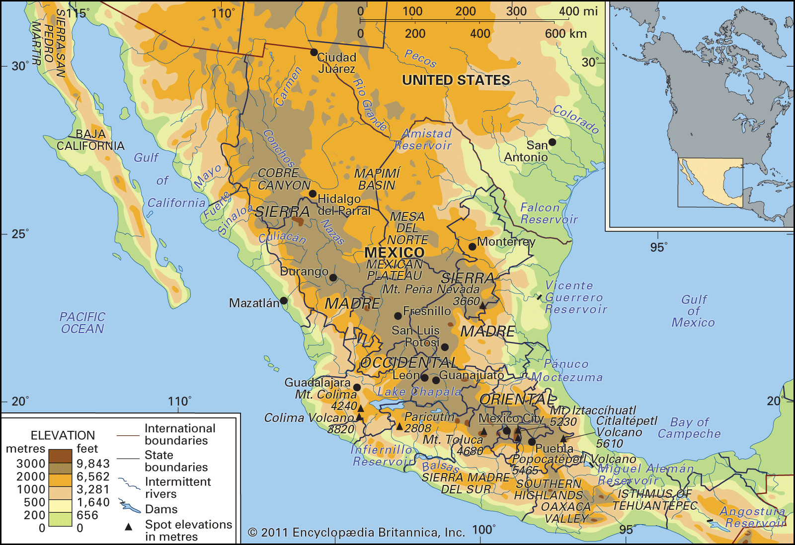
The Mesa Central, located south of the Mesa del Norte, features fertile valleys and volcanic peaks. This region, with its moderate climate, has historically served as the country’s agricultural center. The Bajío, known as Mexico’s breadbasket, is located within the Mesa Central. The region’s volcanic history has also contributed to soil instability, posing challenges for infrastructure in areas like Mexico City.
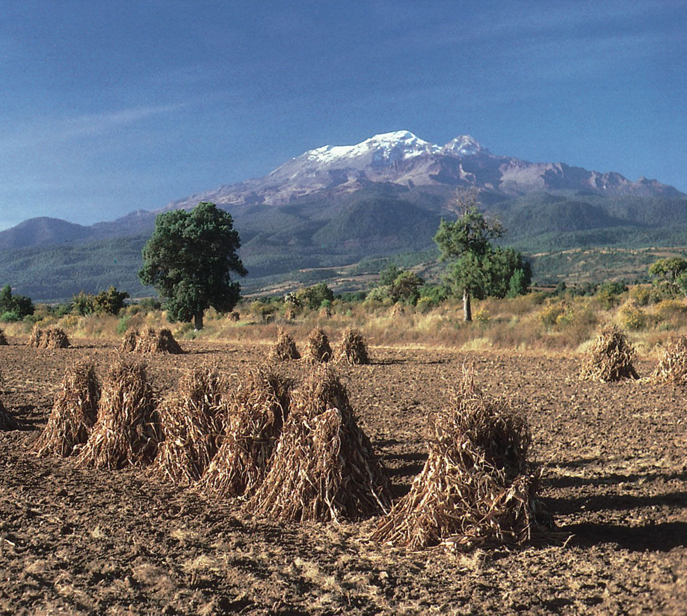 Iztaccíhuatl volcano, Puebla state, Mexico
Sierra Madre Occidental: A Western Barrier
Forming the western edge of the Mexican Plateau, the Sierra Madre Occidental is a volcanic range averaging 8,000 to 9,000 feet in elevation. Deeply carved by westward-flowing rivers, the range is renowned for its spectacular canyons, including the Copper Canyon (Barranca del Cobre) in Chihuahua, a system even larger than the Grand Canyon.
Sierra Madre Oriental: An Eastern Rampart
The Sierra Madre Oriental, situated on the eastern side of the Mexican Plateau, is a folded mountain range primarily composed of shale and limestone. Considered an extension of the Rocky Mountains, it runs parallel to the Gulf Coast, reaching elevations exceeding 12,000 feet. The range is also a significant source of mineral deposits, including copper, lead, and zinc.
Cordillera Neo-Volcánica: A Volcanic Spine
The Cordillera Neo-Volcánica, also known as the Trans-Mexican Volcanic Belt, is a geologically active mountain range stretching across central Mexico. This volcanic arc connects the Sierra Madre Occidental and Sierra Madre Oriental, featuring iconic peaks such as Citlaltépetl (Mexico’s highest peak), Popocatépetl, and Iztaccíhuatl. The region’s volcanic activity is evident in the presence of cinder cones and geothermal features. South of the Cordillera lies the Balsas Depression, a dry region with unique landforms.
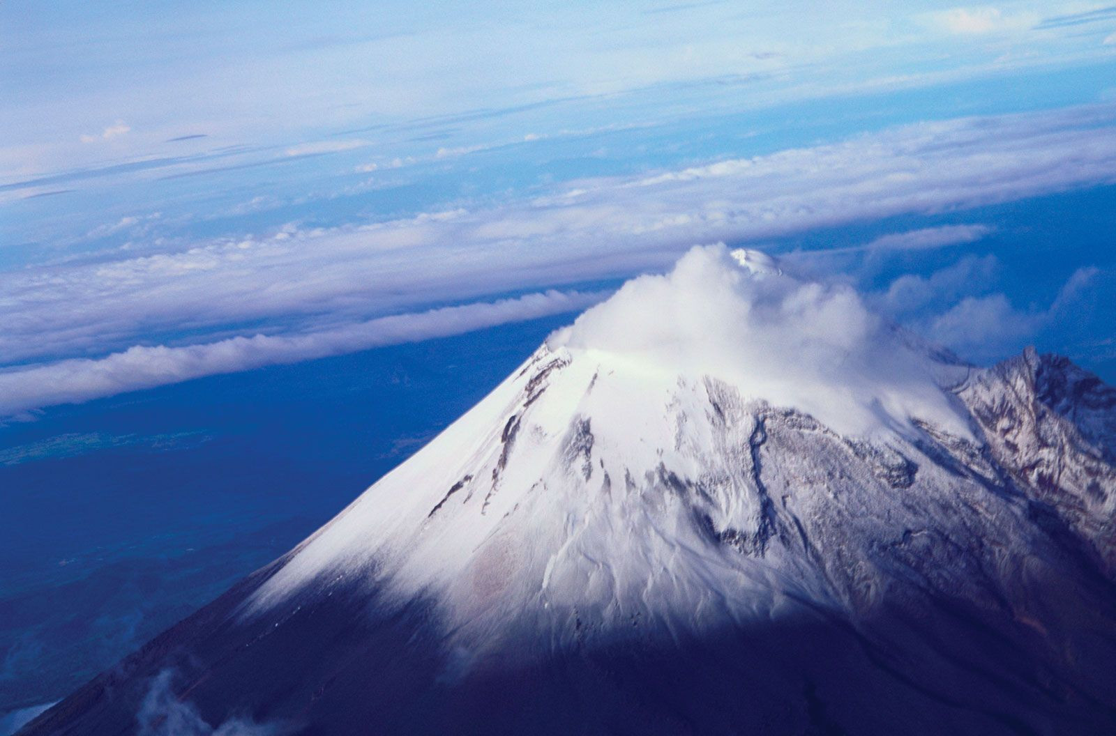 Citlaltépetl, Veracruz state, Mexico
The Gulf Coastal Plain: A Broad Expanse
The Gulf Coastal Plain, significantly wider than its Pacific counterpart, extends along the Gulf of Mexico from the Texas border to the Yucatán Peninsula. Characterized by lagoons, swamps, and low-lying terrain, the plain broadens considerably near the U.S. border. The southern portion of the plain includes the Tabasco Plain, a region known for its petroleum resources.
The Southern Highlands: Complex Terrain
The Southern Highlands comprise a complex series of dissected mountains, plateaus, and valleys. The Sierra Madre del Sur, bordering the Pacific Ocean, features rugged terrain and a beautiful coastline known as the Mexican Riviera. Inland, the Mesa del Sur consists of eroded ridges and isolated valleys, including the Oaxaca Valley, a culturally rich but economically challenged region. The Isthmus of Tehuantepec, a narrow strip of land, separates the Gulf of Mexico from the Pacific Ocean. The Chiapas Highlands, extending into Central America, are characterized by volcanic peaks and fertile valleys.
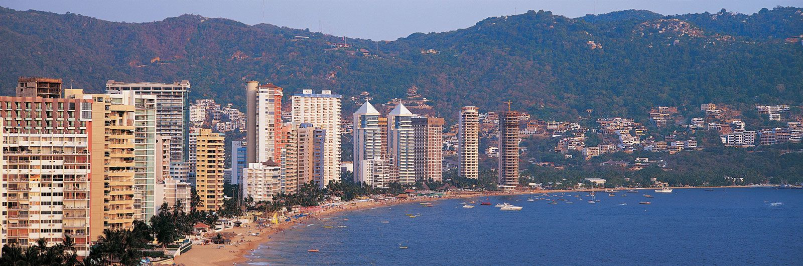 Acapulco, Mexico
Yucatán Peninsula: A Limestone Platform
The Yucatán Peninsula, northeast of the Tabasco Plain, is a unique region with a flat limestone landscape. Characterized by sinkholes (cenotes) formed by the collapse of underground caverns, the peninsula has minimal surface drainage. The region’s karst topography creates a distinctive environment that supports a unique ecosystem. The peninsula separates the Gulf of Mexico from the Caribbean Sea and is home to popular tourist destinations like Cancun.