Cancun, Mexico, a jewel in the Yucatan Peninsula, is world-renowned for its stunning beaches, vibrant nightlife, and rich Mayan history. For travelers planning a visit to this popular destination, understanding its geography is key to an unforgettable experience. A Map Of Cancun Mexico is not just a navigational tool; it’s your gateway to exploring everything this tropical paradise has to offer.
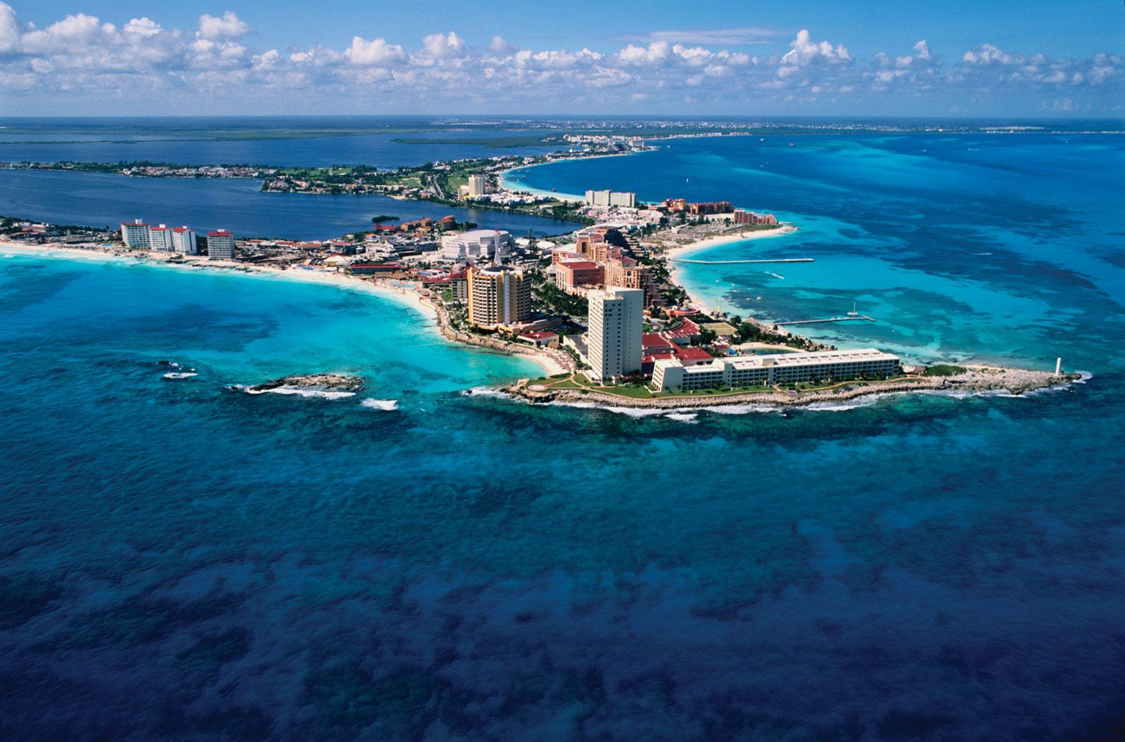 Aerial view of Cancun coastline, Mexico showcasing beaches and turquoise waters.
Cancun is geographically divided into two main areas: the mainland city of Cancun and the Hotel Zone, a long, narrow island also known as Isla Cancun. This island, connected to the mainland by bridges, is where the majority of resorts, beaches, and tourist activities are located. Understanding this distinction is crucial when looking at a map of Cancun.
A detailed map of Cancun Mexico reveals the layout of the Hotel Zone, showcasing its linear structure along the coast. Avenida Kukulkan is the main artery of the Hotel Zone, stretching for approximately 14 miles (22.5 km) and hosting an array of hotels, restaurants, shopping centers, and entertainment venues. Maps clearly delineate the different sections or “zones” within the Hotel Zone, which can be helpful for orienting yourself and planning excursions.
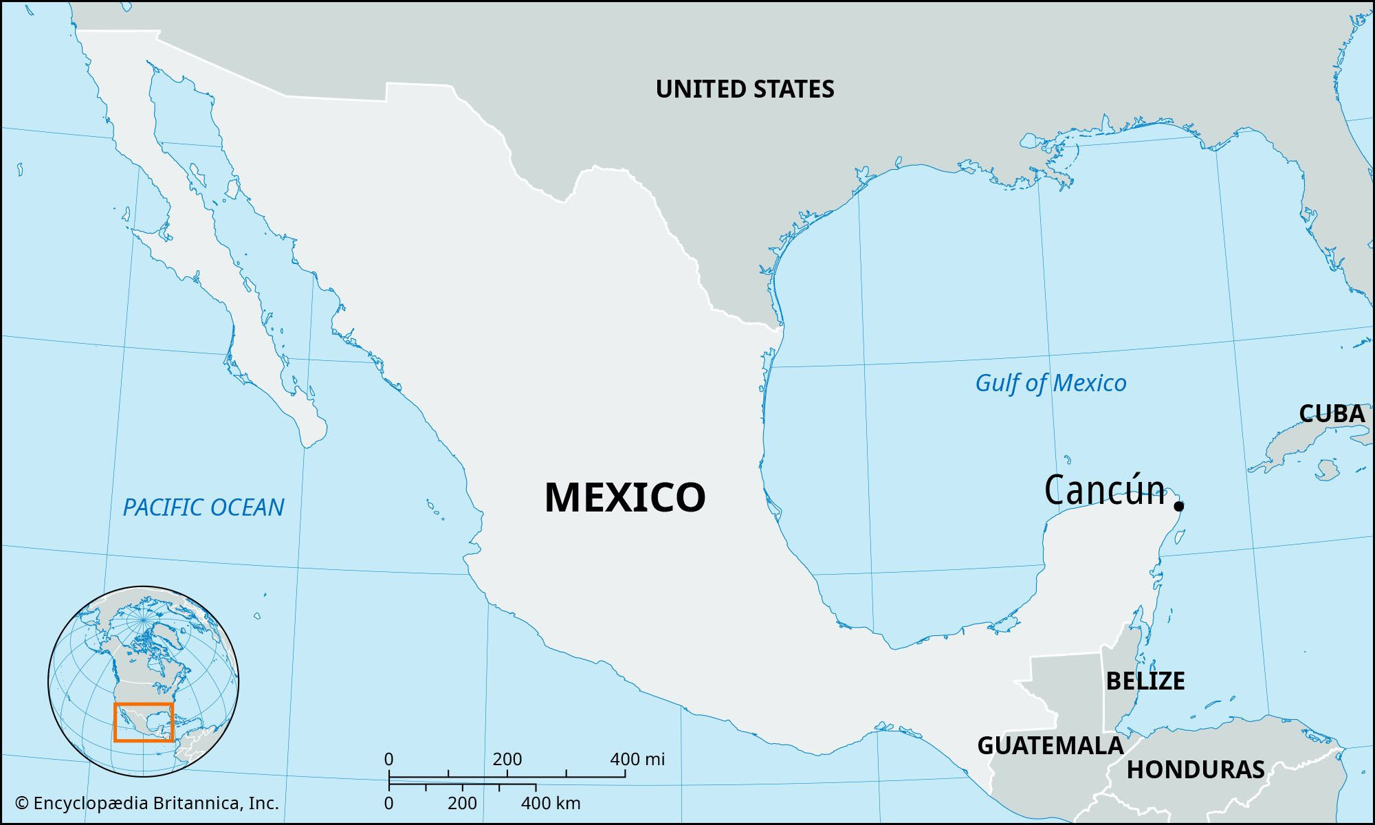 Location map of Cancun, Mexico highlighting its position in Quintana Roo and the Yucatan Peninsula.
Beyond the Hotel Zone, a map of Cancun extends to the downtown area, or “Ciudad Cancun,” which offers a more authentic Mexican experience. Here, you’ll find local markets, restaurants serving traditional cuisine, and a glimpse into the everyday life of Cancun residents. A map of downtown Cancun will guide you through its grid-like streets, helping you discover hidden gems and navigate to local attractions.
Different types of maps of Cancun Mexico cater to various needs. Tourist maps often highlight popular attractions, points of interest, and transportation routes, particularly within the Hotel Zone. Street maps provide detailed layouts of both the Hotel Zone and downtown Cancun, essential for navigating by car or public transport. For those interested in exploring beyond Cancun, regional maps show Cancun’s location within the Yucatan Peninsula and its proximity to other destinations like Playa del Carmen, Tulum, and Mayan ruins such as Chichen Itza.
Key landmarks to identify on any map of Cancun include Punta Cancun, the northern tip of the Hotel Zone where many nightclubs are concentrated; the Cancun International Airport, located south of the city; and the ferry terminals at Puerto Juarez and Punta Sam, offering connections to Isla Mujeres. Locating these points on a map provides a valuable framework for understanding Cancun’s overall layout.
In conclusion, whether you’re planning to relax on pristine beaches, explore ancient Mayan sites, or immerse yourself in vibrant Mexican culture, a map of Cancun Mexico is an indispensable tool. It empowers you to navigate this captivating destination with confidence, ensuring you make the most of your Cancun adventure. By familiarizing yourself with a map, you unlock the key to discovering all the wonders Cancun has to offer.