Mexico City boasts one of the most extensive and efficient public transportation systems in the world: the Mexico City Metro. For locals and tourists alike, understanding the Metro is key to navigating this vibrant metropolis. This guide will delve into the Mexico City Metro map, providing valuable insights for a seamless travel experience.
 The Mexico City Metro System
The Mexico City Metro map, displayed prominently in every station, is a crucial tool for understanding the city’s layout. Long-time residents often use the map not just for navigating the subway, but also for referencing surrounding streets and neighborhoods. The intricate network of lines and stations can seem daunting at first, but with a little guidance, it becomes remarkably easy to use.
Decoding the Mexico City Metro Map
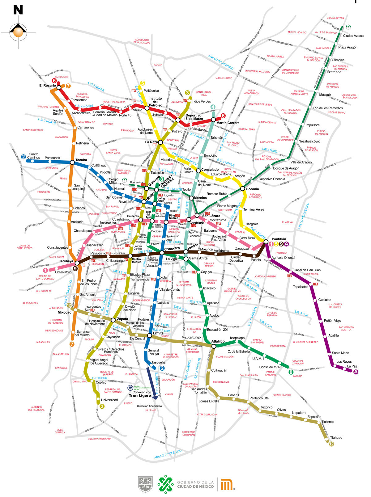
There are two primary versions of the Mexico City Metro map. One version displays the Metro lines superimposed on a city street map, providing context and aiding in locating specific destinations.
 CCDMX Metro without streets
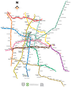
The other version presents a simplified view, focusing solely on the interconnected web of Metro lines. This streamlined representation highlights the system’s structure, allowing riders to quickly plan their journeys. As Eduardo Villegas, Coordinator of the Historical and Cultural Memory of Mexico, noted, “For me, the city was divided into Metro stations, and I think that for those of us who use public transportation, it’s a shared experience.” This sentiment underscores the Metro’s integral role in shaping the city’s identity and how its inhabitants perceive it.
Beyond the Basic Map: Integrated Transit and Station Guides
While the Mexico City Metro map provides a comprehensive overview of the subway system, navigating the city often requires understanding how the Metro connects with other modes of transportation. A comprehensive map of the integrated transport system, available for download, offers a broader perspective on the city’s interconnected transit network, incorporating buses, trams, and other modes of public transportation. This comprehensive map enables travelers to plan multi-modal journeys, seamlessly transferring between different forms of transportation.
Furthermore, a detailed station-by-station guide to the Mexico City Metro provides a wealth of information about individual stations, including nearby landmarks, points of interest, and helpful tips for navigating the surrounding area. This resource offers a deeper understanding of each station’s unique character and its connection to the city’s fabric.
Planning Your Trip: Utilizing Resources and Staying Informed
For those new to the Mexico City Metro, online resources provide valuable information on the system’s operation, fare structures, and rider etiquette. Understanding these basics beforehand ensures a smooth and enjoyable travel experience. For real-time assistance, LOCATEL, a city information service, is available 24/7 to answer questions and provide guidance.
In conclusion, the Mexico City Metro is a vital artery of this bustling metropolis. By understanding the nuances of the Mexico City Metro map and utilizing available resources, navigating the city becomes an effortless and rewarding experience. From the simplified network map to the integrated transit overview and detailed station guides, a wealth of information empowers both residents and visitors to explore Mexico City with confidence.